giovedì 20 dicembre 2007
martedì 18 dicembre 2007
lunedì 17 dicembre 2007
domenica 16 dicembre 2007
ISABELA ISLAND_ GALAPAGOS : UNREACHABLE PARADISE

Requirements and procedures for long films or photographic sessions.
REQUIREMENTS AND PROCEDURES FOR FILMING AND/OR PHOTOGRAPHS
It is possible to make films and photographs at Galápagos within the protected areas of Galápagos National Park and Galápagos Marine Reserve for educational, research and commercial purposes.
A permit from the Galápagos National Park Directorate must be granted to make films or photographs within these two protected areas. The following procedures must be followed for this purpose:
- Fill out a film or photograph request form. The applicant’s original signature is mandatory. It may be sent by regular mail, fax or email enclosing copies of passports or identification cards of the staff to make the film or photographs as well as the transportation itinerary in which the work will be completed).
- Once this information has been received, the proposal will be analyzed by the DPNG Technical Committee which will decide if it is accepted or not. If it is, it will designate the category of the project (commercial, educational or scientific) which shall determine the costs to be paid.
- Once the analysis has concluded, the applicant will be notified immediately if its project has been accepted including the costs to be paid for fees and guarantees and the bank accounts where they are to be deposited.
- Once the deposits have been verified an agreement will be drafted and signed (originals of the agreement are to be signed).
- Starting from the signing of the agreement, the producer will have one calendar year for the free delivery of its production for the use of the Galápagos National Park:
o In the case of films, four copies should be delivered (2 copies in Mini DV and 0 copy in DVD); and
o In the case of photos, one copy of the entire photographic material.
o Guarantee: Amount to be established according to the category of the film and photography. This guarantee shall be returned at the completion of all of the obligations stipulated in the Agreement including copies of the production. - If copies of the production are not received within the established period, then Galápagos National Park shall cash the guarantee.
- When productions exceed 30 minutes of production, fees and guarantees shall increase to 100% of their amount.
NOTE: All documentation and information regarding this procedure shall be sent to the individual responsible at Communication, at email comunicacion@spng.org.ec
0 -------------------------------------------------------------------------------------------------------------
giovedì 29 novembre 2007
venerdì 31 agosto 2007
venerdì 3 agosto 2007
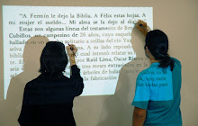
SEGUNDO PUNTO CERO _ CATEQUILLA
 CATEQUILLA, PICHINCHA
 El monte Catequilla es un sitio único, porque la
estructura montañosa de los andes equinocciales
permite realizar estas observaciones, gracias al
relieve montañoso occidental y oriental por
condiciones favorables para la triangulación.
Lo que no es posible en ningún otro sitio alrededor
del mundo por donde pasa el paralelo 0. En Kenya
está en una llanura. Lo más que puede hacer allí fue
poner un pie en un hemisferio y el otro en el otro,
para la foto, que ahora descubro que no fue en la
'Mitad del Mundo' africana.
Solo en el solsticio de verano del 21 de junio cada
18,7 años puede observarse en Ecuador, en el singular
sitio arqueológico, el fenómeno lumínico de alineación
del sol y la luna, al terminar ésta su
periplo.

giovedì 2 agosto 2007
PRIMER PUNTO CERO 30 JULIO 2007

When I started to think a project called AEQuator, I did not know very well how to develop it. I knew it was all about a metaphoric drawing of the contradictions that come together at parallel 0, the line that crosses through our countries and displaced lives, I have seen in this work - which is a laboratory of ideas and a nomadic observatory – the opportunity of photographing an imaginary line. The paradox in this action translates in the useless intent of measuring scientifically a non existent line, a bit like trying to codify and define our countries which deny themselves.
Photography is used as a testimony of the intangible, and are complemented by video used as a drawing of people, situations, cultural expressions, imaginaries which follow the traces of the imaginary stripe.
0 ------------------------------------------------------------------
Cuando comenzamos César Meneghetti y Maria Rosa Jijon a plantear la idea de hacer un proyecto llamado AEQuator, no sabíamos bien como desarrollarlo. Sabíamos que se trataría de un trazado metafórico de las contradicciones que se funden en el paralelo cero que atraviesa nuestros países y nuestras vidas desplazadas. Hemos visto en este proyecto, que es un laboratorio de ideas y un observatorio nómada, la oportunidad de fotografiar una línea imaginaria. La paradoja que puede representar este hecho, o esta acción, se traduce también en el intento casi inútil de medir científicamente una línea que no existe, un poco como intentar definir y codificar un país que se niega a sì mismo.
Las fotografías que sirven de constatación de lo inservible se van a contraponer a los registros en video que ilustran lo que la línea va dibujando, las gentes, las situaciones, las expresiones culturales, los imaginarios que caminan paralelamente a este trazado intangible.
martedì 31 luglio 2007
PERDERNALES_01 JULY 29-30 2007
giovedì 28 giugno 2007
martedì 19 giugno 2007
TO WALK A LINE / CAMINAR LA LINEA
sabato 16 giugno 2007
GPS

El Sistema de Posicionamiento Global ("Global Positioning System" - GPS) es un sistema de navegación compuesto de una flotilla de satélites puestos en órbita por el Departamento de Defensa de los Estados Unidos, y sus estaciones en tierra firme. Usando GPS, uno puede detrminar automaticamente su posición (latitud y longitud) en la tierra. Funciona continuamente en todas partes del mundo y es disponible a todos libre de cargos. Con orígenes en aplicaciones militares secretas, GPS se ha convertido en parte de nuestra vida cotidiana.


